Utilizing technology to increase our teams efficiency and capabilities continues to be an approach used to provide more value to our clients. Drone technology is one tool to do more in less time and expand services offered. Drones have proven to be a useful piece of technology adding value to all stages of a project including planning, design, and construction.
Preparing For Takeoff
Incorporating drones into a business operation is more than just purchasing a drone and flying it. In order to operate commercially, drone pilots need to obtain their FAA Part 107 license. Operating commercially also requires pilots to check airspace regulations and other flight restrictions before takeoff. Our experienced drone pilots are well versed in what regulations, if any, apply to project sites. Flights also need to be planned around weather conditions, not only for compliance with FAA regulations but also for desirable results depending on project needs.


Aerial photo of large park project. Drone images on this project allowed us to examine turf development and issues with sprinkler patterns/overlap.

Drone imagery and software was used to generate an orthomosaic base map under our site survey to identify damaged concrete and asphalt for proper tie-in locations for proposed improvements, verify utilities, and identify drainage concerns.
How Are Drones Used to Increase Efficiency and Expand Capability?
Drones fill a variety of roles that complement the services we offer:
- Planning figures/exhibits: Aerial drone photos combined with specialty processing software assists in the production of hi-resolution orthomosaics, increases the ability to document existing conditions, aids in creating CAD base maps from aerials, and generates contours accurate enough for planning level documents. Field work that previously would have taken several days using traditional GPS equipment can now be collected with a drone in several hours.
- Construction Documentation: Drone imagery allows the efficient capture of construction progress. Paired with specialty software, repeating specific flight paths on regular intervals allows for time lapse video creation and construction documentation for easy comparison of site progress.
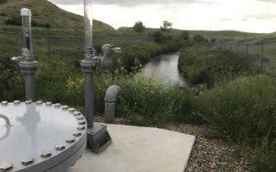
- Base Mapping: One of the biggest advantages of utilizing drones is in conjunction with GPS topographic surveys. Flying a site after survey with ground control points (GCPs) allows staff to process images with a higher level of accuracy. Images can be incorporated into a high-resolution orthomosaic in correlation with survey data to help eliminate extra site visits and also document existing conditions should concerns of damage arrive during construction. The images allow operators to see damaged asphalt or concrete extents, drainage issues, and marked utility lines.
- Volumetric Surveys and Topography: Drones paired with specialty software are also utilized to generate a 3D point cloud model of gravel piles allowing the determination of volume for each individual pile within the project site. Great West has provided volumetric surveys with our GPS equipment in the past, but incorporating drones has equated to greater efficiency and safer survey of gravel piles. We recently used drone technology to survey all gravel pits of a Montana County in a single day versus five to six days using traditional GPS equipment. Through the use of specialty software, we are also able to generate surface contours from the 3D point cloud.
Can Drones Help You?
Drones are another tool to provide the value our clients have come to expect from Great West Engineering. As drones are utilized as specified above, we continue to evaluate new ways to deliver more for less through utilizing technology. An emerging usage is the documentation of flooding events. With spring upon us we are not far from runoff and heavy spring rains that typically produce flooding. Many cities and counties have been impacted by flooding and have utilized FEMA disaster programs to help rebuild. Identifying the full impacts of a flood event can be challenging, but the ability to quickly fly over a flood in progress is invaluable to help quantify the impacts on a community and give a high resolution flood extend boundary for high water events.
To find out more about how we can utilize emerging technology to assist your community, contact us today!
LATEST NEWS

Summer Interns 2024
As the school year comes to an end and summer begins, we are excited to pass our knowledge and experience to the next generation of leaders in the engineering industry. One of our most cherished core values is ensuring that our employees feel empowered, and this...

Importance of Grant Administration
At Great West Engineering, we've been making a positive impact on communities for over three decades. We've successfully completed thousands of infrastructure projects by utilizing state and federal grants and low-interest loans. Our comprehensive professional...
Preserving and Conserving the Resource at Hill County’s Beaver Creek Reservoir
Located approximately 10 miles south of Havre in Hill County, Beaver Creek Reservoir (also known as “First Lake”) is one of two reservoirs within Beaver Creek Park. The dam, constructed of earth fill, is over 100 feet tall and stores more than 6,000 acre-feet of...