Town of Broadus and Powder River County, Montana
Floodplain Study/Letter of Map Revision (LOMR)

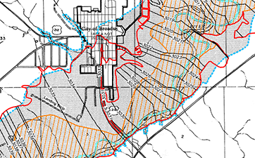
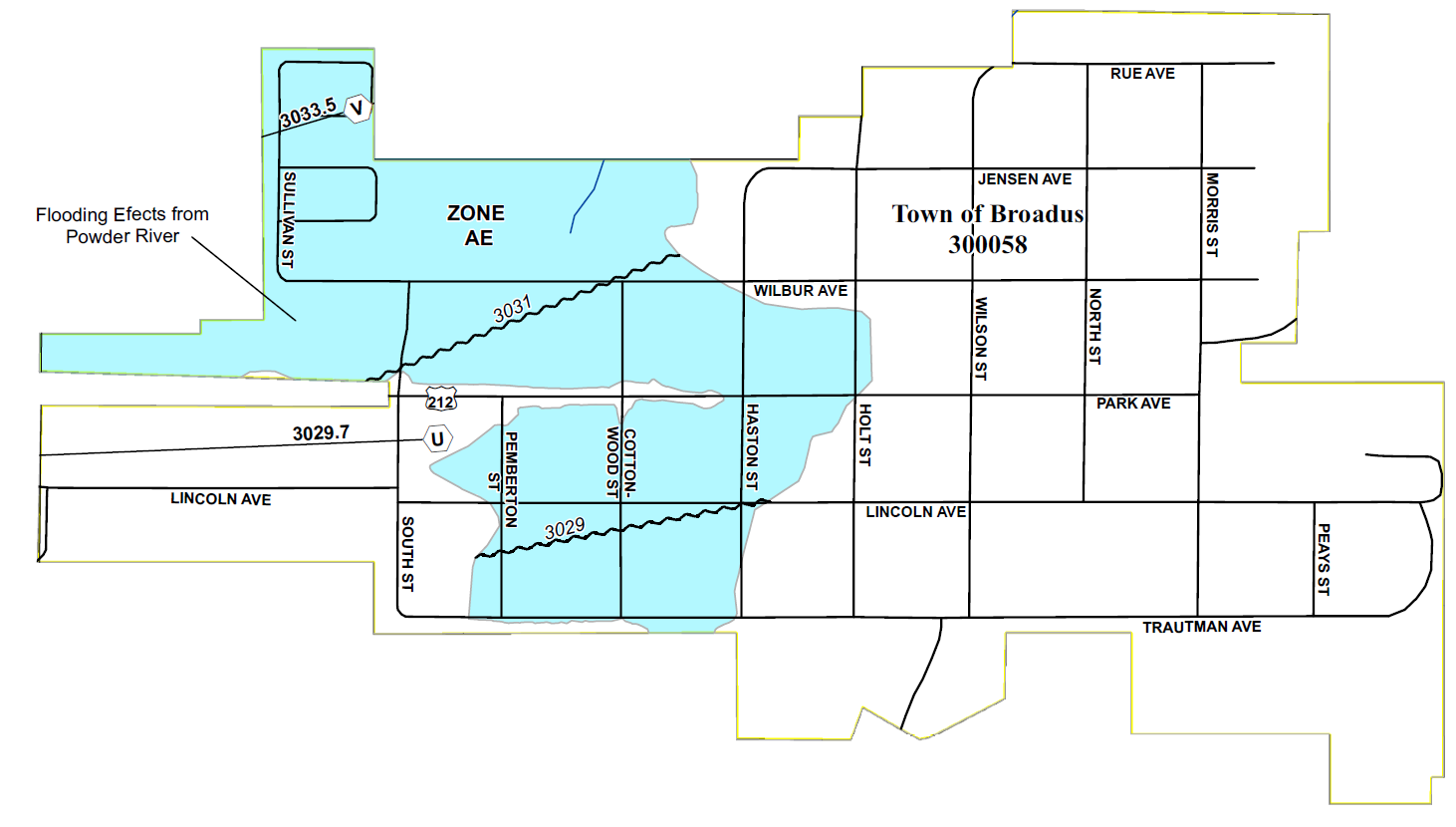
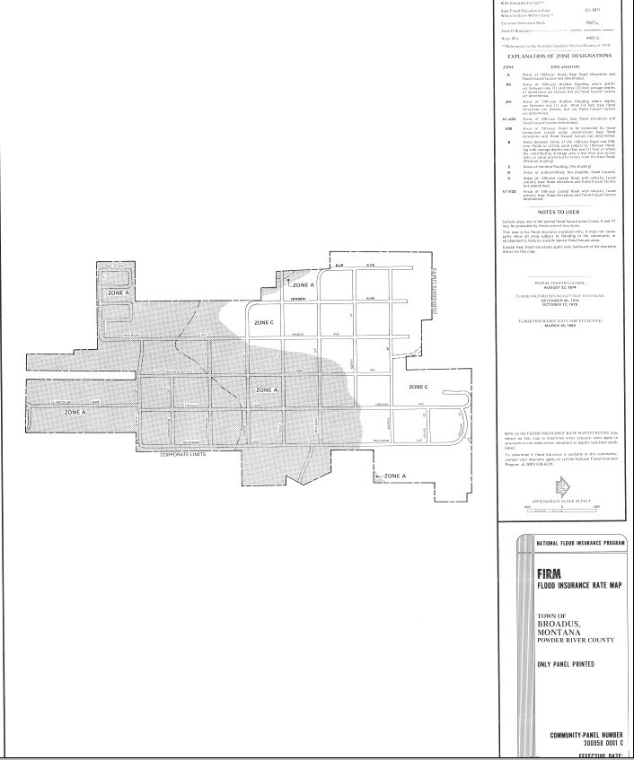
The Town of Broadus experienced historic flooding from the Powder River in 1978. In response, FEMA issued approximate-level floodplain maps to show the flood risk to the Town and Powder River County. The approximate level maps, with no Base Flood Elevations or Floodway defined, made floodplain administration a difficult task. Great West responded to this need and completed a new floodplain study for this area. The study extends for 6 river miles, approximately 2 miles upstream and 4 miles downstream of the highway bridge. The study involved topographic and bathymetric survey of the Powder River and the surrounding floodplain area. Peak flows were calculated by performing a logarithmic interpolation from one upstream and one downstream streamflow gages. Hydraulic computations were performed in a 1-dimensional HEC-RAS model. The LOMR was subjected to a rigorous review by FEMA and the Montana DNRC.
Project Highlights
- Topo-bathymetric survey of the Powder River
- 6 river miles of 1D hydraulic modeling
- Hydrology analysis using USGS streamflow gage data
- FEMA Letter of Map Revision (LOMR)
- Funding
- Coal Board - $20,000
Project Photos
View More Natural Resources Projects
Storage • Distribution • Treatment • Supply • Hydraulic Modeling • Preliminary Engineering Reports/Facility Plans
Work With Us
BILLINGS | BOISE | GREAT FALLS | HELENA | SPOKANE