In 1968, Congress enacted the National Flood Insurance Program (NFIP) to reduce future flood losses through local floodplain management and to provide protection against potential losses through flood insurance for property owners. As part of the NFIP, floodplain maps are developed to show properties located within a Special Flood Hazard Area (SFHA). SFHAs are defined as the area that will be inundated by the flood event having a 1% chance of being equaled or exceeded in any given year (also commonly known as the 100-year flood or base flood).


Under contract with the Montana Department of Natural Resources and Conservation (DNRC), with funding from the Federal Emergency Management Agency (FEMA), Great West completed a floodplain study of the Jefferson River. The study extended from the confluence of the Big Hole and Beaverhead Rivers down to Willow Creek for a total of 61.5 miles. Broadly speaking, the purpose of the study was to protect public health and safety, which supports the three-pronged approach of the NFIP, as shown in the figure above.
Floodplain studies are comprised of many pieces of data. These data pieces are ultimately used to develop a computer model that calculates where floodwaters will go. The model also calculates the depth and velocity of the floodwaters. Data includes terrain or elevation, land cover, and peak flow (measured in cubic feet per second).
The Jefferson River floodplain study utilized both 1-dimensional (1D) and 2-dimensional (2D) hydraulic models. 2D models were created first to predict flow patterns and identify flow splits. Videos showing the results of the 2D models are shown on the left (video 1 – Whitehall area, video 2 – Highway 359 area). The 2D model results were used to inform the development of 1D models, which ultimately served as the basis for the development of the floodplain boundaries and mapping.


After the hydraulic models are completed and approved by DNRC and FEMA, the floodplain study moves to what is termed the mapping phase. This phase of the project relies heavily on Geographic Information Systems (GIS) to process and fine-tune the floodplain boundaries.
Once the floodplain boundaries have been completed and approved by DNRC and FEMA, the DNRC goes to work on an extensive public outreach campaign, and FEMA goes to work producing the Flood Insurance Study and Flood Insurance Rate Maps.
For this study, the hydraulics and floodplain mapping are approved, and DNRC and FEMA are in the midst of rolling out the floodplain study to the public. The reach of the Jefferson River that Great West was responsible for was part of a much larger study that included the Beaverhead, Ruby, and Madison Rivers and numerous tributaries in Gallatin, Madison, Jefferson, and Broadwater counties. More information on the project can be found at this link. Draft floodplain maps are available at this link.
LATEST NEWS

Great West Welcomes Levi Howell
We are pleased to announce that Levi Howell has joined the Great West Engineering team as a Project Manager in our Boise, Idaho office. With over 11 years of experience in civil engineering, Levi specializes in water and wastewater systems, as well as general...

Kasey Ketterling Joins The Great West Engineering Team
We are pleased to announce that Kasey Ketterling has joined the Great West Engineering team in our Boise office. This marks an exciting opportunity for the local office as we continue to grow our municipal expertise by adding an experienced professional engineer and...
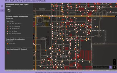
Beyond the Blueprint: How GIS Enhances Engineering & Planning Solutions
Geographic Information Systems (GIS) have become an essential tool for communities striving to make smarter, data-driven decisions. From infrastructure planning to public engagement, GIS provides a dynamic way to visualize, analyze, and manage data across a wide range...