Geographic Information Systems (GIS) have become an essential tool for communities striving to make smarter, data-driven decisions. From infrastructure planning to public engagement, GIS provides a dynamic way to visualize, analyze, and manage data across a wide range of applications.
At Great West Engineering, we’ve seen firsthand how GIS platforms like ArcGIS Online, Story Maps, ArcGIS Hub, and Experience Builder can transform the way clients interact with information. Whether it’s for a specific project or a community-wide initiative, GIS helps administrators, residents, and stakeholders engage with the same up-to-date data through accessible, web-based platforms. One of the fastest-growing areas of GIS application? Public outreach. These tools not only help communities share information they also enable two-way communication that fosters more informed, inclusive decision-making. The examples below highlight several real-world applications of GIS in action.
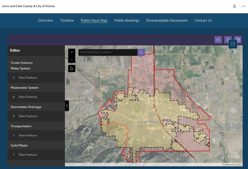
L&C County Joint Infrastructure Study Interactive Public Portal
Public Information Portals – Lewis and Clark County Joint Infrastructure Study
For this project, Great West created an interactive project portal using ArcGIS Online and Story Maps. The portal served as a hub for residents to access project details, draft documents, contact information, and a public engagement map. Community members could also provide input by dropping geographic points with infrastructure concerns directly on the map, along with submitting surveys and comments. All feedback was captured and stored in the system, creating a rich, location-based dataset for decision-makers.
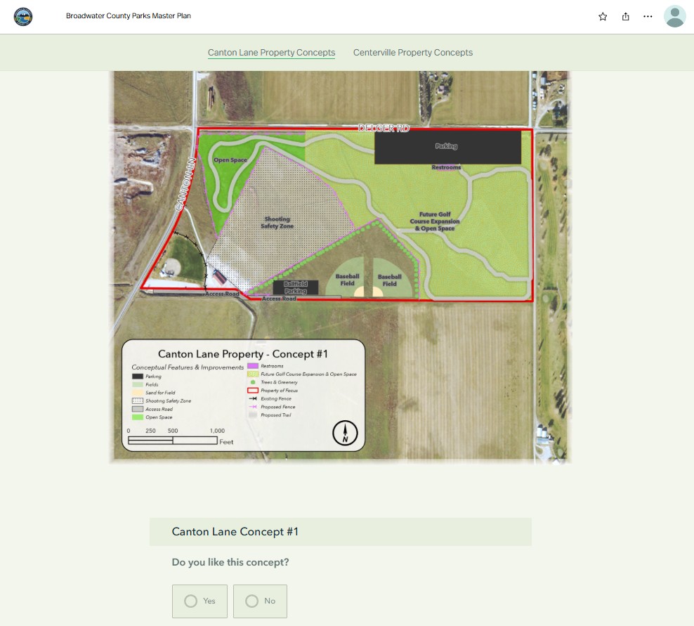
Broadwater County Public Input Platform
Crowdsourcing Public Input – Broadwater County Parks Master Plan
In collaboration with Broadwater County, Great West helped develop and share conceptual park designs for future county parcels using Story Maps. Embedded Survey123 forms allowed residents to submit feedback on each property’s design, with over 300 residents participating. This kind of digital engagement not only gathered valuable insights, but also gave the community a voice in shaping its own recreational spaces.
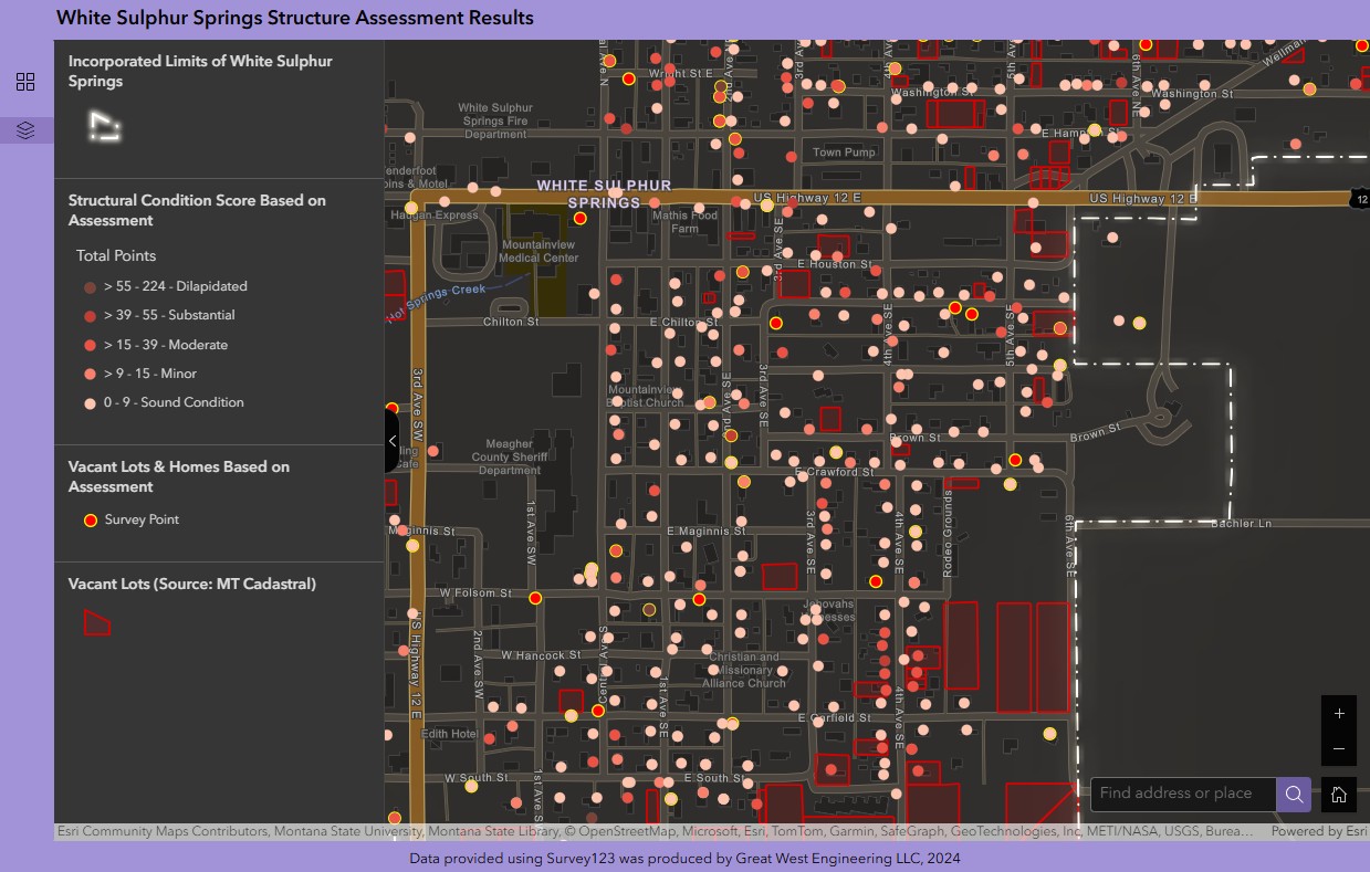
White Sulphur Springs Real Time Portal
Asset Inventory and Condition Assessment – White Sulphur Springs Housing Survey
Working with the Meagher County Stewardship Council, Great West collected housing and structural condition data throughout White Sulphur Springs. Using Survey123, staff and volunteers were able to document residential structures in the field. That data was visualized in real time using ArcGIS Experience Builder, allowing the project team to monitor progress and results collaboratively. The tool, customized for internal use, will soon be available for public viewing—adding transparency and value to the community housing conversation.
GIS has long been recognized for its role in asset management, planning, and data visualization. What’s changing is how accessible and interactive it’s become. Web-based GIS not only improves collaboration and stakeholder engagement, but also makes powerful spatial tools available to a broader audience including those who might not typically work with this kind of technology.
Whether you’re launching a new infrastructure initiative, seeking public input, or simply looking to visualize your community’s assets, web-based GIS offers solutions that are intuitive, impactful, and future-forward. Want to learn how GIS can support your community or project? Contact us today!
LATEST NEWS
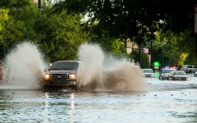
Stormwater Planning – The Calm Before the Storm
Stormwater planning and management often falls behind as a priority for communities. This is understandable with the ever-present demands for providing clean drinking water and adequate collection and treatment of wastewater, along with many other competing needs for resources to keep a community running.
5 Tips to Increase Your Chances of Receiving Grant Funding
A few years ago, Idaho and Montana went from being Lewis and Clark’s rest stops as they endeavored to find the Pacific Ocean to one of the best places in the region to call home. All of us born and raised in these regions, while we aren’t surprised in the least that people want to move here, are finding it challenging to accommodate this unprecedented growth.

Summer Interns 2025
With summer in full swing and classrooms on pause, it’s time once again to welcome a new class of bright minds ready to dive into the world of engineering. At Great West, we believe in investing in future leaders, and our internship program is one way we live out our commitment to growth, mentorship, and empowerment.